Tuesday, August 19, 2008

The road home

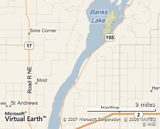
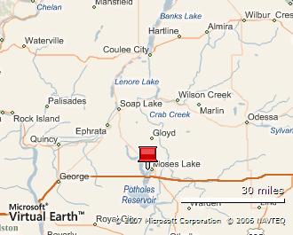
From Coulee, I headed south again to Soap Lake, but then veered west through Ephrata. This route passes by George, close to the Gorge Amphitheatre home of many outdoor concerts due to the reliable weather.

Before reaching Vantage is the Wild Horses  Viewpoint. This overlooks the Columbia from the east side.

IMG_5203 IMG_5208 IMG_5212

While there I noticed an odd rustling sound which seemed to be coming from these paperlike plants.

IMG_5214

From here I took the road west... One oddity (for mid August) was the severe fog that hit Snoqualmie Pass, as if night had overtaken day by several hours...

Drive carefully!

Grand Coulee Dam

Nearly a mile long. 550 feet high, the Grand Coulee Dam is the fourth largest hydroelectricity producer on the planet. It's also the largest concrete structure in the United States. Again scale on the photos was an issue - it wasn't easy to fit the full dam into the pictures.

IMG_5178 IMG_5174

Being summer I guess, not much water was flowing...

IMG_5155 IMG_5159

If you're there at night, expect a laser show which may have something to do with this contraption.

IMG_5164

A note on driving

Well a few...

I'm a little concerned about the driving skills around here (and I suspect this is the visitors and not the locals)

  • On my journey from Ellensburg to Vantage I saw a tire bouncing down the westbound I90 at a good 60-70 miles per hour. Luckily the median was pretty wide but I was worried for more than a few moments that it might cross over.
  • A lot of the RV drivers seem to be weekend ones. i.e. they forget that
    1. They're towing a big thing that makes them longer
    2. They're towing a big thing that makes them slower

The number of times someone cut across me on a left turn from a stop sign... Even better when they wait, then cut across me.

The other problems were more natural, lumps of wood that came from I know not where. Tumbleweeds assaulting the car and finally dust storms.

One afternoon the dust was so bad that near visibility was severely diminished - mini twisters were forming off the road - and it looked like fog was rising over the lakes.

Steamboat Rock

North of the dry falls (2 east, then 155 north) the Corridor continues, now along Banks Lake.

Map image

Again, there are plenty of stops though perhaps the most interesting is around Steamboat Rock. The park itself is the largest and best equipped (including an espresso/ice cream retailer) though some of the smaller ones further north are more peaceful.

IMG_5150 IMG_5153 IMG_5181 IMG_5180  IMG_5193 IMG_5190

Dry Falls

At the top end of Lenore Lake (still on the Coulee Corridor/Highway 17) is Dry Falls. This is double whammy. Make a stop at the State Park (also known as  Sun Lakes which has picnics, boating, camping and trails).

IMG_5107 IMG_5109 IMG_5111 IMG_5114

yet within a few miles, more desolate landscapes...

IMG_5103 IMG_5101 IMG_5096 IMG_5100

Continue on the highway another mile or so and you'll find the Dry Falls visitor center overlook. A 400 foot drop and 3.5 mile width, they were 10 times the size of Niagara at their peak.

IMG_5120 IMG_5127 IMG_5135

These cows (or are they buffalo?) should give an idea of scale (this is at 12x zoom of the top left or closest part of the falls).

IMG_5122

... what appears to be an un-flooded pothole... and maybe a salt lake.

IMG_5124 IMG_5123

The Coulee Corridor

If you take highway 17 north from Moses Lake, you'll eventually get to Soap Lake. This is a sleepy little town and a good place to stop if you need to stretch.

Before you get there, if you're paying attention, you'll notice the rocks littering the plains the highway cuts through. Not just the odd rock here and there, but thousands and thousands seemingly dropped out of the sky.

They were actually dumped by the flood from many miles 'upstream' and now the area is known as the Ephrata Fan, with the city of Ephrata a few miles to the west.

North of Soap Lake is where it gets interesting though. Almost every time I turned a corner, my jaw dropped and I had to be disciplined about not stopping at every opportunity. What the pictures won't do justice to is the scale - just remember the floods peaked at 2000 feet of water.

IMG_5085 IMG_5091 IMG_5089

Moses Lake

I made Moses Lake my base this time around.

Map image

As seems to be the way with Best Western's, the hotel was very accessible, just off the I90. However, as the city is sprawling, this was several miles from the center, so nowhere really to walk to. On the plus side, it's right on the lake and has it's own lounge and restaurant.

IMG_4999 IMG_5003 IMG_5011 IMG_5057

South of the I90 is the Potholes Reservoir of the Scablands. First formed by the great flood, the water level was then raised by the O'Sullivan Dam. Nearly 10 miles from north to south, it starts to look more like a bay than a lake.

IMG_4988

Just east of here is the nature reserve where there is more boating and trails into the Scablands. You also get to see how stark the landscape can be and what it takes for vegetation to survive, even close to the waterside.

IMG_4989 IMG_4990

Monday, August 18, 2008

The Washington Columbia

Not far from Ellensburg, the 90 crosses the Columbia. Just before the bridge is the small settlement of Vantage. I'm wondering if the name stems from 'vantage point' or similar phrase since views abound up and down the river as well as to the East.

IMG_4944 IMG_4949

Vantage is also home to the Ginkgo Petrified Forest. Don't go expecting a mass of trees though - the visitor center has a few samples.

IMG_4942 IMG_4945

There are some trails a few miles to the west, though given the 100 degree highs you'll forgive me for not exploring... There is some wildlife at the center though, some I saw and some I didn't want to.

IMG_4963 IMG_4969

Water-sports are obviously popular around here - there are launches in Vantage and further south - the Wanapum recreational area being one example, though on busy days expect to see people just parked up by the side of the road.

Also to the south is a dam

IMG_4983

... which led to rising waters, luckily some Petroglyphs were saved.

IMG_4970 IMG_4971

Finally, if you want your very own petrified wood, don't steal it, get it from the gift shop which of course is marked by...

IMG_4977